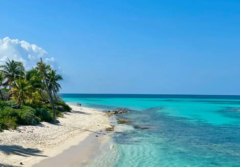


The drive from Marfa to Big Bend unfolds across some of the quietest, most beautiful terrain in West Texas. It begins with long horizons, open desert air, and a slow rhythm on US-90 that feels almost meditative. Light moves gently across the plains, changing the color of the land hour by hour. Cars appear only occasionally, drifting by like small echoes against the wide landscape. The simplicity of the road, the calm pace, and the feeling of open space set the tone for a journey that is both scenic and serene.
For many travelers—especially those visiting the region for the first time—the question naturally arises: what is the Marfa to Big Bend the safest driving route in 2025? The highways are straightforward, but the remoteness makes planning feel important. Visibility, fuel stops, services, and daylight all play a role in shaping a comfortable trip. This guide offers the clarity you need, with comforting detail and a realistic understanding of the roads that connect Marfa, Alpine, and the dramatic desert entrance to Big Bend National Park.
Geography Between Marfa and Big Bend
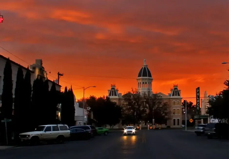
The land between Marfa and Big Bend is a broad sweep of desert valley framed by the Davis and Chisos Mountains. Distances are long, towns are spaced widely apart, and services appear in small pockets rather than frequent intervals. Marfa sits on the high plateau where US-90 crosses open ranchland, while Alpine lies roughly 26 miles east—a friendly hub with gas, restaurants, and accommodations before you head deeper into the desert.

Beyond Alpine, the curve of TX-118 leads south into increasingly rugged terrain, eventually approaching the communities of Study Butte and Terlingua. These small settlements sit at the edge of the national park and offer the last reliable fuel, food, and supplies before you cross into Big Bend.
Tourism boards emphasize the remoteness of this region and encourage visitors to plan ahead for fuel and essentials before making the drive (Visit Big Bend). The National Park Service also notes the significant distances between towns, park entrances, and visitor centers (NPS Big Bend – Directions). Understanding these distances helps you appreciate why certain routes feel more secure than others.
The Safest Driving Route Overview: Marfa → Alpine → Big Bend

The safest route from Marfa to Big Bend follows a clean, predictable sequence of major highways:
Marfa → US-90 East → Alpine → TX-118 South → Study Butte → Big Bend National Park
This route is widely considered the safest way to reach Big Bend from Marfa, not because the alternatives are dangerous, but because it provides:
• Consistent signage
• Reliable fuel and food stops
• Smooth road conditions
• Predictable traffic from other park-bound travelers
• Better cell coverage than remote roads
Alpine serves as a small but important anchor on this journey. As one of the region’s key visitor hubs, its official tourism board consistently promotes Alpine as the central access point for Big Bend-area travel due to its services and friendly driving corridors (Visit Alpine Texas).
From Alpine, TX-118 offers a scenic, gradual transition from mountain foothills into open desert, with clear markers, gentle curves, and a steady flow of visitors heading south.
This route remains the most practical and reassuring option for most travelers in 2025.
Why Many Travelers Prefer Marfa → Alpine → Study Butte → Big Bend
Safety is rarely about one factor—it’s usually a combination of comfort, visibility, services, and knowing what to expect. The Marfa–Alpine–Study Butte route excels in each of these areas.
Access to Gas, Food, and Lodging
Fuel is available in Marfa, again in Alpine, and once more in Study Butte. The National Park Service strongly encourages visitors to fill up in the nearest towns before entering Big Bend due to limited pumps inside the park (NPS Big Bend Safety). Having three opportunities to refuel before reaching the park adds confidence to your trip.
Improved Lighting and Visibility
West Texas roads are famously dark at night, but the approach into Alpine and the stretch leading south on TX-118 offer clearer signage and more regular traffic than remote alternatives.
Steadier Cell Coverage
Coverage is not perfect, but main highways hold signals longer than backroads. This helps with maps, weather checks, and general reassurance.
Because of these combined advantages, most visitors—especially solo travelers and those new to the region—choose this route without hesitation.
Read:Safest Routes From Marfa to Alpine (Day & Night Guide)
Alternative Direct Route
Some drivers look at maps and wonder if they can take the shorter, more direct path from Marfa to Big Bend by following:
Marfa → TX-2810 (Pinto Canyon Road) → ranch roads → Study Butte
This route is undeniably beautiful. Pinto Canyon Road cuts through dramatic desert terrain, offering sweeping canyon vistas, winding curves, and rugged mountain views. Photographers love it, and seasoned desert drivers often describe it as one of the more memorable scenic drives in the area.
But it is not the safest or most practical option for most travelers.
The ranch-road route includes:
• Long stretches with almost no traffic
• Sections with minimal or no cell service
• Narrow road segments and occasional uneven pavement
• No food, fuel, or rest stops
• Greater isolation during breakdowns or emergencies
For experienced off-highway drivers, this route remains a treasured scenic byway. For safety-minded travelers, especially those driving alone or unfamiliar with desert travel, the Marfa → Alpine → TX-118 route remains the more secure choice.
Road Safety Conditions in 2025
Road conditions between Marfa and Big Bend are generally reliable in 2025. Pavement quality is good, signage is clear, and the route sees enough visitor traffic to feel comfortably predictable.
Still, West Texas brings its own considerations.
Wildlife Activity
Deer, javelina, and smaller animals frequently move near the roadside at dawn and dusk. Texas transportation officials consistently warn about wildlife collisions on rural highways and advise slower speeds when visibility is low (TxDOT Wildlife Safety).
Daylight vs Night
Darkness in West Texas is deep. With minimal lighting, night driving demands greater alertness. Daylight trips offer clearer views, better reaction time, and a more relaxed drive.
Typical Weather Patterns
Summer heat can affect vehicle performance, while winter storms—though rare—can bring freezing patches to early-morning roads. Spring winds can move dust across the pavement. Thunderstorms can reduce visibility quickly. The National Weather Service’s Midland/Odessa office covers Big Bend-area forecasts and advisories (NWS Midland/Odessa).
Despite these considerations, the roads themselves are smooth, well maintained, and pleasant to drive for most of the year.
Read:Is Marfa Safe in 2025? Crime, Tourism & Road-Safety Review
Best Time of Day to Drive from Marfa to Big Bend
The best and safest time to make the drive is from morning through early afternoon.
Morning light is crisp and far-reaching. Shadows are low, wildlife tends to settle, and the desert air feels cool and clean. The road between Marfa and Alpine looks especially beautiful in soft morning tones, with mountains rising slowly from the haze.
By midday, visibility remains excellent. The desert’s calm brightness highlights distant hills and makes navigation feel effortless. This is often when you’ll see other travelers heading toward Big Bend, adding a reassuring sense of shared purpose.
Driving at dusk or after dark, however, increases wildlife activity and reduces visibility significantly. Since the final stretch toward Big Bend passes through rural desert with little lighting, many travelers time their drive so they reach Study Butte or the park entrance before sunset.
Fuel, Food & Service Planning Along the Route
One of the biggest advantages of choosing the Marfa to Big Bend safest driving route is that it offers the region’s most dependable service stops.
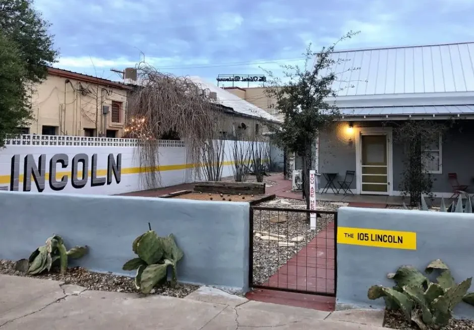
Marfa
Fuel, coffee, light groceries, art shops, and cafés. A good place to top off before setting out.
Alpine
Multiple gas stations, larger grocery stores, hardware shops, and restaurants. Alpine remains the recommended point to refuel fully before you continue south toward the park (Visit Alpine Texas).
Study Butte / Terlingua
Fuel, a small grocery market, cafés, and park-oriented accommodations. This is your last stop before entering Big Bend.
Inside the national park, fuel is available only at Panther Junction and Rio Grande Village, and availability can change without much notice. That’s why service planning is such a key part of the drive.
Read:Safest Time of Day to Visit Prada Marfa
Scenic Highlights on the Safer Route
Choosing the safest route does not mean sacrificing scenery. In fact, the Marfa → Alpine → TX-118 corridor delivers some of the most classic West Texas views.
Between Marfa and Alpine, the grasslands stretch broad and open beneath tilted mesas and distant mountain silhouettes. As the day brightens, the land shifts color—pale gold at sunrise, warm sand midmorning, soft amber by late afternoon.
Approaching Alpine, the Davis Mountains appear gently on the horizon, framing the town in a shallow valley that feels sheltered compared to the open desert.
Once you turn south onto TX-118, the landscape becomes wide and sweeping, with long straightaways leading into pockets of volcanic rock, rolling hills, and panoramic desert basins. The descent toward Study Butte is dramatic and memorable, with each mile offering a little more of the Chisos Mountains rising in the distance.
This route gives you both safety and beauty—something travelers appreciate deeply.
Weather Considerations for 2025 Travelers
Weather plays a quiet but important role in the comfort of the drive.
Summer Heat

Temperatures can rise quickly, especially in July and August. Carrying extra water for yourself and your vehicle is a simple precaution.
Winter Cold Snaps

December and January can bring freezing temperatures in the early morning. Some drivers encounter small patches of frost on shady curves, especially near Alpine’s higher elevations.
Spring Winds

March and April often bring gusty winds that can create drifting dust across the pavement. These winds are usually manageable but worth noting if you drive a high-profile vehicle.
Thunderstorms

Summer monsoon storms can appear suddenly, with intense rain for short periods. Watching radar or forecasts through the National Weather Service can help you plan the best departure time (NWS Midland/Odessa).
Despite seasonal patterns, most days offer clear skies and steady visibility—ideal conditions for a peaceful drive.
Solo Traveler Guidance
For solo travelers, the Marfa to Big Bend route is particularly comfortable when you choose the well-traveled main highways.
Check your fuel before leaving Marfa, and plan a brief stop in Alpine to top off fully. Download offline maps in case you pass through pockets of reduced service. Sticking to US-90 and TX-118 ensures that you remain on clearly marked highways with predictable curves and occasional fellow travelers.
Let someone know your estimated arrival time, especially if you’re heading into the park in the late afternoon. These are simple travel habits, not signs of danger—just the kind of grounding steps that help anyone stay comfortable when exploring rural landscapes.
Many solo travelers describe this drive as soothing rather than lonely. The combination of long views, quiet roads, and a steady sense of direction creates a peaceful rhythm that’s hard to find elsewhere.
Read:Safest Places to Stay Near Prada Marfa
Final Thoughts
The journey from Marfa to Big Bend is one of the most memorable drives in Texas—open, quiet, and bathed in soft desert light. Choosing the Marfa to Big Bend safest driving route simply makes the experience more serene and confident. Traveling through Alpine and down TX-118 gives you a blend of practicality, visibility, and breathtaking scenery.
When you understand the landscape, the spacing of services, and the rhythm of daylight across the desert, the drive becomes more than a route—it becomes part of the adventure itself. It’s a reminder of how spacious, peaceful, and beautiful West Texas can be.
Take your time, travel in daylight, keep your fuel comfortable, and enjoy the slow, sweeping horizons on your way to Big Bend.
FAQs
What is the safest route from Marfa to Big Bend in 2025?
The safest and most reliable route is Marfa → Alpine → Study Butte → Big Bend via US-90 and TX-118. It offers the most services, clearest signage, and best visibility.
How long does the drive take?
The trip typically takes between two and two and a half hours, depending on stops and your final destination inside the park.
Is it safe to drive this route at night?
It is safer and more comfortable to travel during daylight. Nighttime brings deeper darkness, increased wildlife activity, and reduced visibility.
Are there fuel stops along the way?
Yes. You can fuel up in Marfa, Alpine, and Study Butte. Inside Big Bend, fuel is available only at Panther Junction and Rio Grande Village.
Is this a good route for solo travelers?
Absolutely. The main highways are well maintained and used by many visitors. Daylight travel, a full tank, and downloaded maps make the trip smooth and reassuring.
Are the alternative ranch roads safe?
They are scenic but remote. Limited traffic, minimal cell service, and no fuel or services make them less ideal for safety-focused or first-time travelers.

I am a passionate writer who creates engaging, creative, and meaningful content that informs, inspires, and connects with diverse audiences.